


Wilson Voting District, Fulton County, Arkansas
About
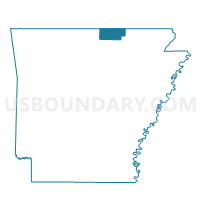
Outline

Summary
| Unique Area Identifier | 526495 |
| Name | Wilson Voting District |
| County | Fulton County |
| State | Arkansas |
| Area (square miles) | 35.37 |
| Land Area (square miles) | 35.37 |
| Water Area (square miles) | 0.00 |
| % of Land Area | 100.00 |
| % of Water Area | 0.00 |
| Latitude of the Internal Point | 36.47118810 |
| Longtitude of the Internal Point | -91.69948620 |
Maps


Graphs
Select a template below for downloading or customizing gragh for Wilson Voting District, Fulton County, Arkansas


Neighbors
Neighoring Voting District (by Name) Neighboring Voting District on the Map
- Mammoth Springs Voting District, Fulton County, AR
- Myatt Voting District, Howell County, MO
- South Fork Voting District, Fulton County, AR
- Thayer No. 2 Voting District, Oregon County, MO
- Washington Voting District, Fulton County, AR
Top 10 Neighboring County Subdivision (by Population) Neighboring County Subdivision on the Map
- Thayer township, Oregon County, MO (3,975)
- Mammoth Spring township, Fulton County, AR (2,035)
- Myatt township, Howell County, MO (655)
- South Fork township, Fulton County, AR (485)
- Washington township, Fulton County, AR (406)
- Wilson township, Fulton County, AR (278)
Top 10 Neighboring Elementary School District (by Population) Neighboring Elementary School District on the Map
Top 10 Neighboring Unified School District (by Population) Neighboring Unified School District on the Map
- Salem School District, AR (4,684)
- Thayer R-II School District, MO (3,859)
- Mammoth Spring Schools, AR (2,608)
- Oregon-Howell R-III School District, MO (1,627)
Top 10 Neighboring State Legislative District Lower Chamber (by Population) Neighboring State Legislative District Lower Chamber on the Map
- State House District 151, MO (37,152)
- State House District 153, MO (35,762)
- State House District 82, AR (28,911)
Top 10 Neighboring State Legislative District Upper Chamber (by Population) Neighboring State Legislative District Upper Chamber on the Map
Top 10 Neighboring 111th Congressional District (by Population) Neighboring 111th Congressional District on the Map
Top 10 Neighboring Census Tract (by Population) Neighboring Census Tract on the Map
- Census Tract 5502, Fulton County, AR (6,287)
- Census Tract 5501, Fulton County, AR (5,958)
- Census Tract 906, Howell County, MO (5,182)
- Census Tract 4802, Oregon County, MO (4,490)
Top 10 Neighboring 5-Digit ZIP Code Tabulation Area (by Population) Neighboring 5-Digit ZIP Code Tabulation Area on the Map
- 65775, MO (24,908)
- 65791, MO (4,585)
- 72576, AR (3,868)
- 72554, AR (2,923)
- 65692, MO (1,332)
- 72520, AR (309)